DC Water is a large water utility serving over 700,000 residents and nearly 26 million annual visitors, including critical customers in the US government. It also serves parts of the surrounding jurisdictions and federal areas outside the District of Columbia. DC Water has approximately 1,300 miles of active water mains and the average water main is around 80 years old. This aging infrastructure requires effective planning and a robust asset management program. The team at DC Water leverages technology to identify and prioritize pipe replacement projects based on risk, effectively maximizing the value of its capital as well as its operations and maintenance dollars.
In 2024, DC Water embarked on modernizing their GIS System by moving from ArcMap to ArcGIS Pro. This is a complex process because their current GIS database is highly interconnected with their asset management platform and field apps, and these interconnections must be maintained. But this upgrade will provide enhanced asset management capabilities, network tracing, and computing power (64-bit vs 32 bit), and is better suited for heavy geoprocessing, 3D rendering, and large datasets. As part of this GIS migration, the team reevaluated their asset management and water distribution system modeling software.
DC Water has historically used disparate software solutions for their water, sewer, and asset risk modeling. The data exchange amongst these platforms and the underlying asset inventory platform (ArcGIS) involves implementation of various data pipelines and steps which require time and effort from staff and could introduce an opportunity for errors in data transfer. The data in the models was also static, only reflecting one moment in time and requiring continual updates.
DC Water chose to streamline their technology to a single platform with AquaTwin Water, AquaTwin Sewer, and AquaTwin Asset. With AquaTwin products, DC Water can operate with a fully integrated hydraulic and asset model with real-time results available within the ArcGIS Pro interface.
DC Water evaluated various hydraulic modeling software packages to use in conjunction with their new GIS system, and AquaTwin products stood out because of their seamless integration and compatibility with ArcGIS Pro and the entire ArcGIS Pro ecosystem, and their intuitive and user-friendly interface. Aquanuity’s products support DC Water plans to have a fully integrated Asset Management and Hydraulic Modeling platform.
With AquaTwin products, hydraulic model results feed directly into the asset risk/capital planning model, allowing for a truly hydraulics-based asset management program and yielding a more robust approach to ensure customer service and reliability across the system.
Bret Dorgan, a hydraulic modeler and data analyst at DC Water, said “We are striving to impellent a fully integrated Asset Management and Hydraulic Model ecosystem. The interoperability within the AquaTwin suite of products is very seamless and in line with our objectives.”
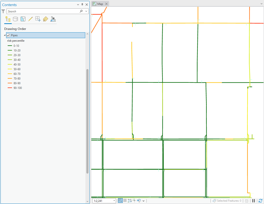
In a first step toward their AquaTwin implementation, DC Water built out their existing water network risk prioritization model in AquaTwin Asset and verified that the results aligned with their existing model developed in 2018. This model calculates various consequence and likelihood of failure factors to help the team at DC Water understand the highest priority assets to include in future pipe renewal and replacement projects, providing a repeatable and defensible method for prioritizing asset renewal.
The original risk prioritization model for DC Water was complex, built out through extensive research and collaboration with consultants. With 26 likelihood of failure (LOF) and 57 consequence of failure (COF) factors, many factors have an impact on the model results. The LOF checks include analyses of the physical condition and performance of existing infrastructure. COF checks include proximity to critical customers, potential hazards, reliability, hydraulic performance, potential transportation impacts, and more. The consequence of failure is pronounced in a city with so many critical customers. There are individual checks within the model to prioritize uninterrupted service for these critical customers. The final total COF and LOF scores are calculated based on weighted multifactor scores.
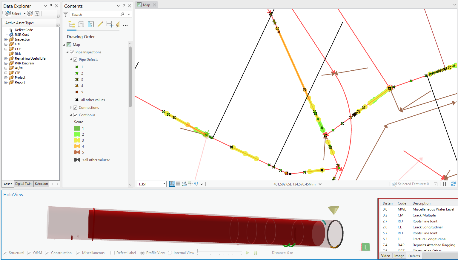
Some of the checks in this model require complex geospatial analyses. When evaluating whether water mains are near a building, for example, the model examines 75,000 water main asset segments to determine their proximity to over 160,000 buildings in Washington DC. AquaTwin Asset produces most of the COF and LOF results instantaneously, but even those that require the heaviest analysis can be performed in as little as several minutes. DC Water has a huge dataset and complex spatial needs, and they need modern technology and powerful computing to run complex analyses quickly.
The complex model and geospatial needs of DC Water highlighted the full extent of capabilities within AquaTwin Asset and led to the development of new features in the product.
Building the Risk Prioritization Model – Converting DC Water’s existing Risk Prioritization model to AquaTwin Asset involved implementing each parameter from the previous risk model within the new project. AquaTwin Asset’s intuitive user interface simplified the process, and its flexible options allow evaluation of risk factors individually or as a batch. The powerful and quick analysis enabled efficient quality control and corrections to the model.
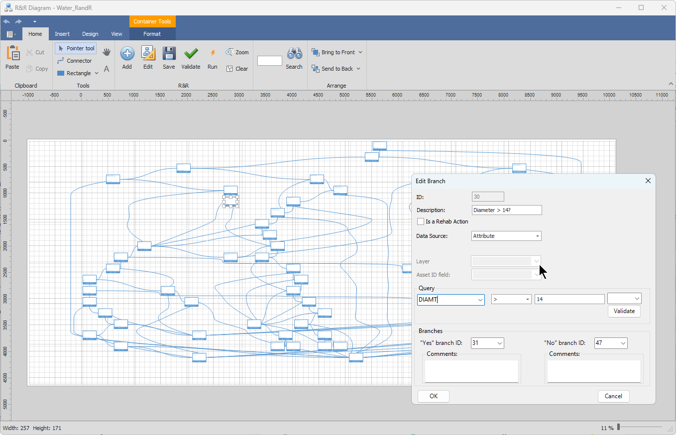
Rehab and Replacement Decision Tree and Cost Model – DC Water implemented a comprehensive rehab and replacement decision tree and cost model. The decision tree goes through multiple tiers of decisions until the water mains are sorted into a rehab outcome, which also includes a cost model to estimate the price tag of the recommended actions for a single asset or a package.
The Aquanuity team partnered closely with DC Water in implementing the new model. Throughout this process, several new features were implemented within AquaTwin Asset which significantly improved the model’s performance, including enhanced risk calculations, enhanced spatial analysis, and increased flexibility in the risk model setup.
With the model setup successfully completed, once DC Water fully migrates to ArcGIS Pro with AquaTwin Water, AquaTwin Sewer, and AquaTwin Asset, the powerful functionality of Aquanuity products integrated with ArcGIS Pro will be realized. This will enable enhanced functionality including hydraulics-based criticality, machine learning, and artificial intelligence analysis tools. The DC Water team made strong progress toward this goal by building their Risk Prioritization Model in AquaTwin Asset and verifying the results in the new system. They look forward to moving toward a fully integrated water and sewer hydraulic and asset model in ArcGIS Pro.